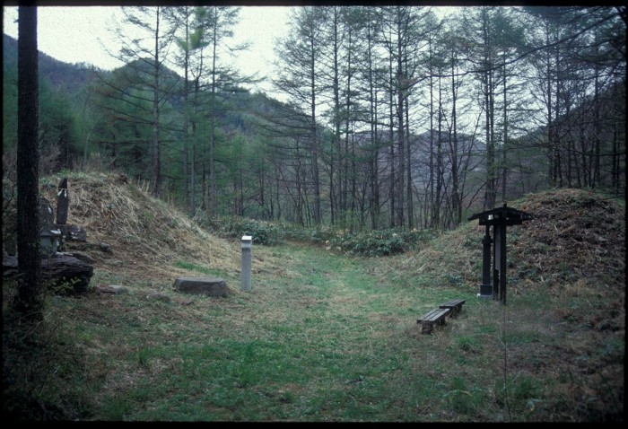
One of the aids for both travelers and the people who worked on the highways in the early Edo period were regular distance markers, similar to the notion of ‘mile posts’ seen on Western roads. Rather than a simple post or stone pillar, however, Japanese highways were typically marked by large earthen mounds known as ichirizuka. The literal meaning is ‘one ri mound’, a ri being a standard measure of distance equivalent to 2.44 miles. In other words, mounds of earth were piled up, usually one on each side of the road, for every ri traveled from Edo. Nihonbashi was considered the terminus of all roads in Japan, and so all measurements were calculated from the center of this bridge, as they still are today.
Although the mounds were prominent, they were made more distinctive by planting a tree on the top. In most cases this was a hackberry tree (enoki), but pine (matsu) was a common alternative. Occasionally, an ichirizuka might have been bedecked with plum, cherry, or bamboo. Not only did these mounds offer a convenient measure of how far a traveler had come, or had to go, but they also served as an indisputable measure for settling the charges for porters and carriers (so much per ri). In the more remote parts, especially when traveling through forest or woodland, the appearance of an ichirizuka must have also provided assurance to travelers that they were on the right route. Perhaps though, this is more the case for walkers who attempt to trace the old route today, in places where the old highways have diminished to no more than mere footpaths.
Towards the end of the Edo period porters tended to charge a fixed rate between post-towns rather than ichirizuka, and with a proliferation of travel guides most travelers knew exactly where they were most of the time anyway. The usefulness of these mounds declined, therefore, and many began to be pulled down and built upon. A mid-nineteenth century survey, for example, found that in the 126 ri distance between Kusatsu and Itabashi post-towns (on the Nakasendo), only 107 ichirizuka survived and that of these, only 103 had double mounds. Since then the vast majority have disappeared, to be commemorated only as a place name or a small wooden marker. Of the ones which do survive some, like the double mound just north of Itabashi post-town, have become famous landmarks. The best preserved continuous stretch of ichirizuka on the Nakasendo, however, is in the remote area of forested highland along the six and a half ri length of highway between Mitake and Oi post-towns. With revived tourism along the Nakasendo, some ichirizuka have been reconstructed recently, including that at Shinchaya near Magome.

